The Medicine Bow Rail Trail extends 21 miles, winding through the Medicine Bow National Forest. Mile markers along the trail are distances from the original starting point in Laramie. Trail segments, from one trailhead to the next, are described below.

Pelton Creek to Vienna – 5.6 Miles
The Pelton Creek trailhead marks the southern end of the Rail Trail. Facilities include a restroom, picnic table and gravel parking area where parking is free. The entire fence at this trailhead was replaced by the Friends of the Medicine Bow Rail Trail in 2021 thanks to a grant from the Albany County Recreation Board.
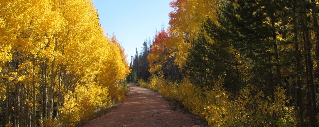
The path is resurfaced with small gravel and it has slightly rolling terrain. There’s a slight uphill going from Pelton Ck to Vienna. This segment offers great solitude and has probably the least traffic. Cows like the route, though, and they can create divots on the trail if it’s wet.
The Mullen Fire crossed the trail as it nears Vienna and is evident in the distance at the Pelton Creek Trailhead. The Vienna Trailhead itself was the edge of the 2018 Badger Creek Fire that came right up to the fence and burned the north side.
Vienna to Woods Creek – 5.0 Miles
The Vienna trailhead has free parking but lacks any additional facilities. It is well suited for horseback riders to load and unload their horses. The corral was partially burned in summer 2018 and was repaired by Friends of the Medicine Bow Rail Trail in 2019 thanks to a donation by Cycle Wyoming.
The Badger Creek Fire burned along this segment of the Rail Trail in 2018. Signage and the corral were damaged at the Vienna Trailhead and were repaired by the U.S. Forest Service and Friends of the Medicine Bow Rail Trail in 2019. The trail offers a wonderful mode of travel to inspect the impacts of this recent fire.
The trail along this segment is resurfaced with small gravel. The Woods Creek trailhead includes a restroom, picnic table and a gravel parking area with free parking. The trail is resurfaced but needs more use to keep vegetation from encroaching onto the path. The trail passes through a small segment of the 2003 Gramm forest fire, making it interesting to see how the forest is coming back in areas not re-burned in the 2018 Badger Creek Fire. There are a few hints of the Mullen Fire nearer the Wood’s Creek Trailhead, but most of this segment was unaffected by the Mullen Fire.
Woods Creek to Lincoln Gulch – 4.4 Miles
The trail crosses Highway 230 with easy-to-open gates on each side of the highway. Use caution when crossing the highway. The trail from Highway 230 north to Fox Park is unimproved and it can be rough in segments although vehicle use has created a hard-packed surface in two lanes. A culvert washout was repaired in 2007 but resurfacing was not completed. It will be resurfaced eventually. While the route is rough, it is fine via mountain bicycle and is very scenic with a large pond (where beaver action created the culvert washout). Watch for moose near the pond.
The Rail Trail reroutes through Fox Park due to the lack of access for a short segment of the railbed. This is why this segment is longer (4.4 miles) than indicated on the trail mileage indicator, stating it is 3 miles. There’s a steep but short drop from the railbed to the gravel road that curves through Fox Park. Follow Forest Road 512 for a short distance before taking the 90-degree turn onto Forest Road 517, heading north. Follow this road just past Fox Park and then turn north, back onto the Rail Trail. Signage marks the detour.
The Lincoln Gulch trailhead has a gravel parking area where parking is free and a restroom donated by Cycle Wyoming.
The trail from Fox Park to Lincoln Gulch Trailhead shows heavy impacts from the Mullen Fire. Much of the area was clear-cut just prior to the fire, limiting the area where burned trees remain standing.
Lincoln Gulch to Lake Owen – 5.4 Miles
This segment of trail is the most bicycle-friendly of all the trail segments due to the more compacted surface. Parking at either end and doing an out-and-back is an excellent route for a family outing. The trail is resurfaced with small gravel and the terrain is flat to rolling. About halfway along this segment, the trail passes through the 2012 Squirrel Creek Fire scar. But the 2020 Mullen Fire is very evident along this segment of the Rail Trail. Note the burn formed a mosaic of burned and untouched areas. As of summer 2022, some areas are pretty stark yet with extensive evidence of the big fire.
The Rail Trail is non-motorized but illegal ingress and egress by OHVs is chronic in this section due to the proximity to Forest Road 552, the Lake Owen Road, and the poor condition of that road. Any motorized use of the Rail Trail is illegal, unless it is a U.S. Forest Service authorized vehicle.
The trailhead at Lake Owen includes a restroom, picnic tables, and gravel parking area that requires a parking pass. The caboose at the site, along with the information boards, were heavily damaged by the 2020 Mullen Fire. The caboose that was once at the trailhead burned in the Mullen Fire and was removed in 2024. The Mullen Fire is especially evident to the west of the trailhead. The Owen Fire, that burned in 2014, is evident north of the lake.
There is a non-motorized path around Lake Owen that provides excellent access to fishing spots around the lake. A campground and additional parking areas are on the southeast end of the lake and all sites require a day use parking permit.

Lake Owen to Dry Park- 2.1 Miles
The surface of the trail from Lake Owen to Dry Park is softer than other trail segments but it is gradually getting packed down with time and use. The terrain is flat to rolling and passes by a lovely pond before then coming to the 2014 Owen Fire burn scar. The terrain is slightly uphill from the Dry Creek Trailhead to Lake Owen. In the burn area, sediment resulting from the fire has filled the borrow ditches in some segments. The result is erosion across the Rail Trail. Use caution in these short segments.
The Dry Park trailhead lacks any development or facilities, but has a dirt parking area.